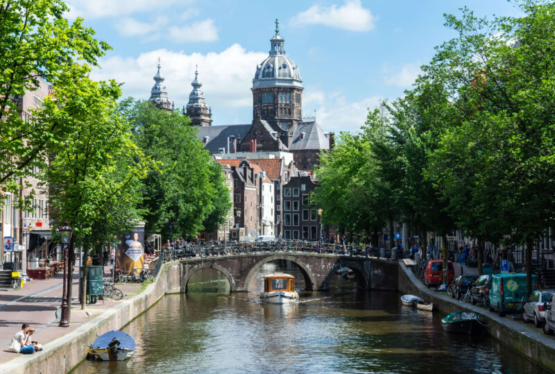
With our Amsterdam Canal District Map you will never be bored in the Canal District. The many shops, restaurants, hotels, attractions and museums ensure that both young and old are entertained. There are also many activities to undertake on or along the canals. Use the map below to explore the canal district. What are you going to do in Amsterdam?
The four canals, from the inside out
Everything on this map is easier to read once you know the order of the canals. Four run in concentric arcs around the medieval centre, and they were dug in that order from 1613 onwards. Learn them from the inside out and you can place any address in the centre of Amsterdam without a map at all.
| Canal | What is on it | |
|---|---|---|
| 1 | Singel | The oldest of the four and originally the city moat. It marked the edge of Amsterdam until the sixteenth century. The floating flower market is on its southern stretch. |
| 2 | Herengracht | The grandest. Merchants with the deepest pockets built here, and the stretch known as the Golden Bend has the widest facades in the city. The Museum of the Canals sits on it. |
| 3 | Keizersgracht | The broadest of the three main canals, named after Emperor Maximilian I. Quieter than the Herengracht and lined with warehouses converted into homes. |
| 4 | Prinsengracht | The longest and the liveliest, named after William of Orange. The Westerkerk and the Anne Frank House stand on it, and the Jordaan begins on its far bank. |
The neighbourhoods on this map
The canals are the grid; the neighbourhoods are what sits in and around it. Each one has its own page with opening times, how to get there and what to book.
| Area | Where on the map | What you find |
|---|---|---|
| The canal district | Inside the belt | The four canals themselves, the Golden Bend, the canal houses and the museums along them. |
| The Nine Streets | Crossing the belt | Nine short streets linking all four canals, full of small shops and cafés. |
| The Red Light District | East of the belt | The medieval core around the Oudezijds Voorburgwal and Achterburgwal, older than the canal ring. |
| The Jordaan | West of the Prinsengracht | A working district from 1612 with markets, hofjes and crooked streets. |
| Museumplein | Just south-west of the belt, beyond the Singelgracht | The Rijksmuseum, the Van Gogh Museum, the Stedelijk and the Moco, all on one open square. |
| The Kalverstraat | East of the belt, inside the medieval centre | The main shopping street, running dead straight from Dam Square to the Munttoren. |
Getting across the map
One tram line crosses almost everything on this map. Tram 2 runs from Centraal Station over the Singel, the Herengracht, the Keizersgracht and the Prinsengracht to the Museumplein, so it cuts through the whole canal belt in about fifteen minutes.
- Tram line 2 — stop by stop, with what to do at each one.
- GVB day ticket — unlimited tram, bus and metro, from € 10.00 a day.
- Lovers canal cruise from Central Station — the classic one-hour loop, leaving every 15 minutes, with an audio guide in 19 languages.
- Metro line 52 — the Noord/Zuidlijn, under the old city in fifteen minutes, with a free archaeological display inside Rokin station.
From the centre outwards: the Singel, the Herengracht, the Keizersgracht and the Prinsengracht. They were dug from 1613 in concentric arcs around the medieval city.
The Herengracht. The section known as the Golden Bend has the widest and most elaborate facades in Amsterdam, built by the wealthiest merchants of the seventeenth century.
Yes. The seventeenth-century canal ring inside the Singelgracht was inscribed on the UNESCO World Heritage list in 2010.
The Singel is the innermost canal and the old city moat. The Singelgracht is the outer ring further out, which marks the boundary of the UNESCO area.
Tram 2 from Centraal Station crosses all four canals on its way to the Museumplein, in about fifteen minutes.
More on our own pages: the Amsterdam & Region Travel Ticket


